Old pictures & history
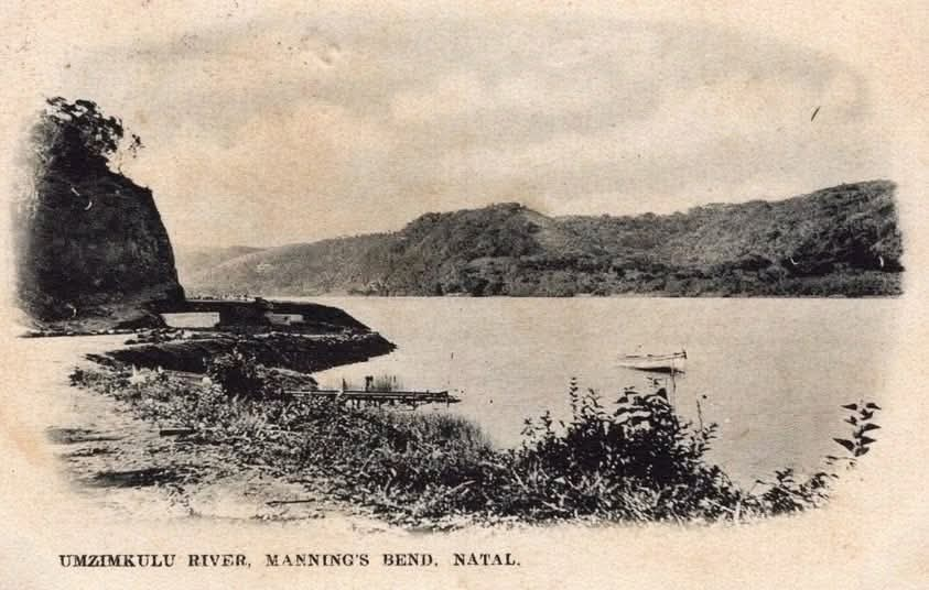
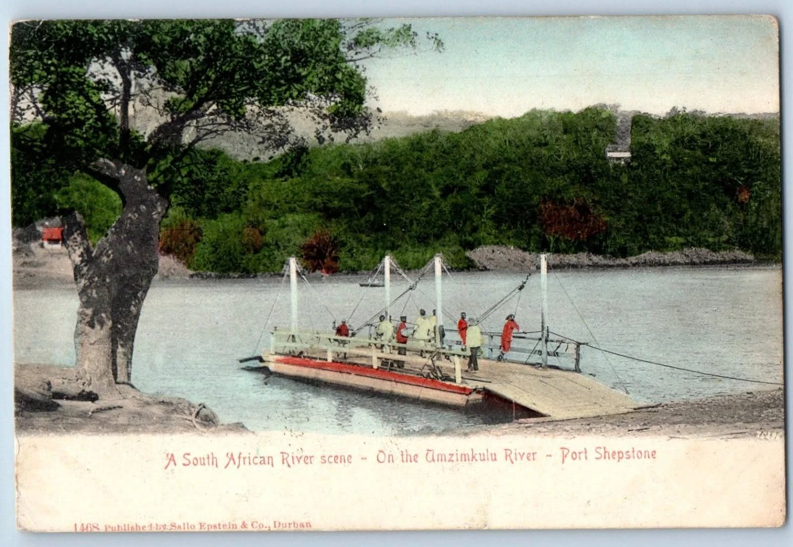
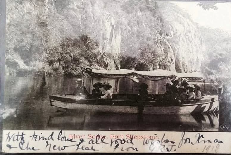
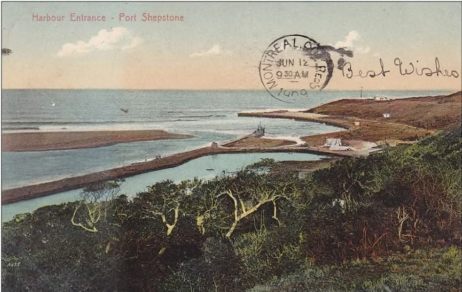
Eagle’s Roost was built in the late 1880s as the Port Master’s House. These plates show the river, the lagoon and the harbour it was built to watch.
The Great Home of Rivers
The Umzimkulu (also written Mzimkhulu or uMzimkhulu) River takes its name from the isiZulu and isiXhosa words meaning “the great home” or “big place of the waters.” Rising high in the Drakensberg near the Lesotho border, it travels roughly 330 km before meeting the Indian Ocean at Port Shepstone — right on our doorstep.
For centuries this river has shaped the land, the people, and the stories of the South Coast.
Early People
Long before European settlement, San hunter-gatherers and later Nguni-speaking peoples lived along these banks. By the early 1800s the area fell under the expanding influence of the Zulu kingdom during the time of King Shaka. The river and its estuary provided fresh water, fish, and fertile ground for homesteads.
A Frontier River
In the mid-19th century the Umzimkulu marked an important boundary. Until 1 January 1866 it formed the southern border of the British Colony of Natal. South of the river lay the sparsely populated region known as “No Man’s Land.” On that New Year’s Day the land between the Umzimkulu and the Mtamvuna River was formally annexed to Natal and became Alfred County.
The Port That Almost Was
Settlers quickly realised the river mouth could serve as a harbour. In the 1870s and 1880s local engineer William Bazley blasted a channel through the rocky reef at the mouth and built the famous Bazley Wall (later reinforced by the Kinsey concrete wall) to keep a navigable passage open.
The first ship, the Somtseu, entered the harbour in May 1880. A fiscal port was established in 1893 and a lighthouse followed. For a short time Port Shepstone (named after Sir Theophilus Shepstone) became Natal’s second harbour, shipping sugar, marble and other goods.
The harbour was always difficult — shallow, silty and vulnerable to floods. When the railway reached the town in 1901 and the first road-and-rail bridge was completed in 1907, the port quickly declined. The old bridge was washed away by floods in 1959 and later replaced by the modern bridges we still use today.
Umtentweni – Between Two Rivers
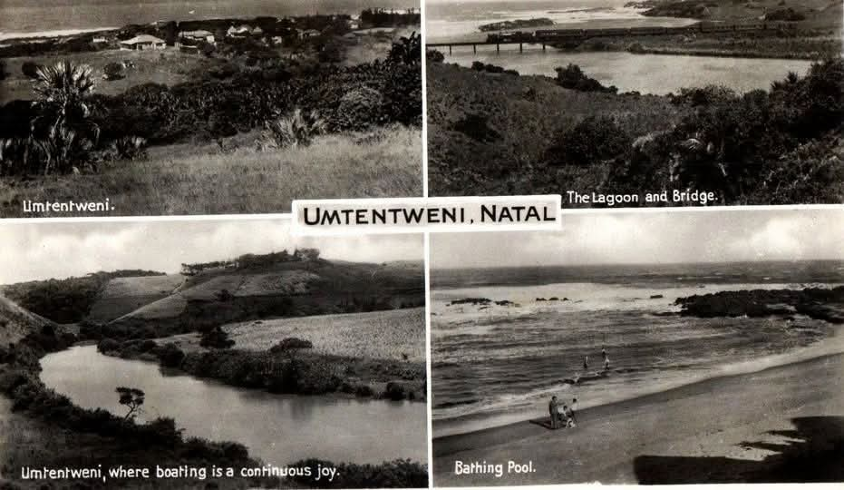
Umtentweni (officially eMthenteni) sits between the Umzimkulu to the south and the smaller Mtentweni River to the north. The name comes from a sharp, pointed grass (umtentweni) that grows along the riverbanks.
What began as a quiet coastal settlement of farms and holiday cottages grew into the peaceful residential suburb and holiday destination you see today. The elevated land, subtropical vegetation, clean beaches and magnificent views over the estuary and ocean have always been its greatest attractions.
Eagle’s Roost and the Port Master’s House
Our own home, Eagle’s Roost, stands on historic Raspberry Lane. The house was built in the 1880s as the Port Master’s residence during the short but busy life of the Umzimkulu harbour. From these verandahs the Port Master once watched ships navigating the treacherous mouth. Today the same views — river, ocean, fish eagles and whales — still greet our guests.
A Living River
Remarkably, the Umzimkulu remains one of the last significant free-flowing rivers in KwaZulu-Natal without a major dam. Its natural flood pulse still sustains rich birdlife, fish populations and the estuary ecosystem that makes this stretch of coast so special for anglers, birdwatchers and nature lovers.